
Redwood City ZIP Code Coverage
The most useful Redwood City ZIP code labels come from the city transportation plan, USPS facility records, and an address-level USPS check. The Redwood City transportation plan supplies area shorthand, while the Redwood City USPS facility listing identifies delivery locations. The USPS address lookup answers the narrower question of which ZIP belongs to one deliverable address.
| ZIP Code | Areas Covered | Post Office | Notes |
|---|---|---|---|
| 94061 | South of Jefferson, including western and southern areas | Woodside Plaza station, 364 Woodside Plaza | Woodside Plaza geography; check city limits in GIS |
| 94062 | North of Jefferson and hillside areas | USPS address verification | City facilities such as Stafford and Stulsaft use 94062 |
| 94063 | Downtown and east of El Camino Real | Main Post Office, 1100 Broadway; Downtown station, 855 Jefferson | County-center and east-side addresses can raise North Fair Oaks questions |
| 94065 | Redwood Shores | USPS address verification | Bay and US-101 geography is separate from the historic core, but it remains Redwood City |
| 94064 | Listed in a USPS destination archive under Redwood City | Not verified | Residential city lists omit it; routing type is a research gap |
| 94025 | Nearby North Fair Oaks and Menlo Park postal geography | Menlo Park mailing geography is common | Not a core Redwood City ZIP; postal city and municipal boundary differ |
94061, 94062, 94063, and 94065 are the core residential ZIP areas tied to Redwood City in the local research. The two caution rows matter because a mailing line can cross a boundary or use a destination label that does not describe a normal city residential area. A ZIP code directory should preserve that uncertainty rather than turn every archive listing into a claim about city residents.
How Redwood City ZIP Searches Work
A ZIP code is a narrowing tool, not a complete resident roll. California's free unclaimed-property search documents a City and ZIP refiner, so a searcher can use 94061, 94062, 94063, or 94065 to sort possible name matches. The assessor, RecorderWorks, and Redwood City eTRAKiT are different. Their documented keys are address, APN, name, document number, project, or permit fields, not a verified whole-ZIP export of occupants.
- Verify the exact delivery ZIP for the address through USPS, and write down the city line exactly as returned.
- Use Community GIS to test whether the address sits inside Redwood City, in nearby North Fair Oaks, or in another county jurisdiction.
- Use the unclaimed-property City and ZIP fields only as a clue, then follow the result through identity proof and the official claim process.
- For parcel or title questions, carry the address into the assessor map, obtain the APN, and use the county record system instead of assuming a ZIP filter exists.
- When a ZIP narrows the area to a street, shift to the Redwood City street directory for address-keyed work.
The sequence separates delivery geography from record custody. It also keeps a name match from being mistaken for a current address. A state search may rank an exact reported property first, but a claim still requires proof. A county map can show a parcel while withholding owner names in its public GIS layer. A city permit system can show a site and project contacts without describing the people who live there.
Redwood City ZIP Filter Fields
The clearest documented ZIP-capable public form is California's unclaimed-property portal. It is designed to locate reported property, not to list Redwood City households, and its optional fields refine a name or business result rather than create a parcel census.
| Field Label | Type | Required | Options or Format Notes |
|---|---|---|---|
| Last or Business Name | Text | Yes | Use a last name or business name as the starting match |
| First Name | Text | No | Refines an individual-name search |
| City | Text | No | Use the reported city as an added location clue |
| ZIP | Text | No | Five-digit ZIP refinement, including a Redwood City postal area |
| Claim | Result control | No | Select a reported property and continue through identity verification |
That field set is useful for a same-name research question, but the result describes reported property and a possible holder relationship. It does not establish that a person lives in Redwood City, owns a parcel, or has a current connection to a ZIP code.
Redwood City ZIP Code 94061
94061 is the clearest south-of-Jefferson slice in the local plan. The Woodside Plaza station at 364 Woodside Plaza gives the ZIP a concrete USPS facility reference, while the western and southern description helps place it in the city's broader neighborhood pattern. A delivery address may still need a boundary check, especially when a search concerns a county service or a parcel near an edge.
For an address in 94061, begin with USPS delivery verification. Then use Community GIS for the municipal question and the county assessor map for the parcel question. The map may return an APN and recorded-map links, but the public parcel layer does not serve as an owner-name directory. If a name is tied to a deed, RecorderWorks is the place to test that recorded event, not the ZIP code itself.
The same distinction helps with personal history. A ZIP can group a period in a directory or newspaper search, yet a street number, old parcel description, or neighborhood name may provide the stronger bridge across years.
Redwood City ZIP Code 94062
94062 is associated with areas north of Jefferson and with hillside geography. City facilities, including Stafford and Stulsaft, use 94062, which shows why a postal label can serve civic locations without acting as a city-limit line. The local research does not establish a separate ZIP realignment date or an emergency-addressing procedure for this area.
Use the USPS lookup for one address and Community GIS for the city boundary. If the question is about a parcel, the assessor map accepts an address or a nine-digit APN and can connect to map references. If the question concerns a person, an address clue can help choose the right local custodian, but the assessment roll, deed index, and historical collections still answer different questions.
Redwood City ZIP Code 94063
94063 covers downtown and addresses east of El Camino Real, including the county-center and east-side geography described in the transportation plan. The Main Post Office at 1100 Broadway and the Downtown station at 855 Jefferson are the local facility references. Nearby North Fair Oaks creates a real jurisdiction problem: a 94063 mailing address does not automatically decide whether city permit, planning, or code files exist.
When a 94063 search touches a building, confirm the parcel in Community GIS before opening eTRAKiT. Redwood City eTRAKiT can search by address, APN, permit type, status, dates, description, or project number, and project results may show site details, contacts, fees, inspections, conditions, reviews, and chronology. Those contacts help date work at an address. They do not prove ownership or residence.
For county matters, the same address may lead to the Assessor-County Clerk-Recorder at 555 County Center or Superior Court at 400 County Center. The city's location as county seat makes several counters close by, but custody remains split between city and county offices.
Redwood Shores ZIP Code Quirk
94065 belongs to Redwood Shores, a Redwood City area separated from the historic core by bay and US-101 geography. That separation is a useful local quirk. A ZIP code directory that sorts only by a compact downtown mental map can miss Redwood Shores, even though the municipal connection remains Redwood City. City library and community facilities confirm the local use of 94065, while USPS remains the right source for a specific delivery address.
For a Redwood Shores record question, keep the same three labels in view: mailing ZIP, city jurisdiction, and parcel situs. Community GIS can supply the city parcel context. County sources may hold assessment and recorded documents. City eTRAKiT may hold permit or planning history. A name search should not be expanded into a neighborhood roster simply because multiple addresses share 94065.
The geography also matters for historical work. Redwood Shores development and annexation form a different address layer from older downtown lots, so a past-resident search may need legal descriptions and development-era records rather than a simple ZIP comparison.
The USPS facility details for Redwood City provide a delivery-side reference for checking postal geography before a ZIP search.
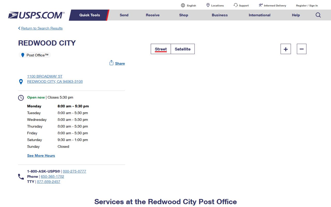
Use the image as a source cue, not as proof of a city boundary. Facility addresses and service areas answer postal questions; they do not replace a parcel or jurisdiction check.
Redwood City ZIP Code Boundaries
ZIP geography and municipal geography answer different questions. The 94025 example is especially clear: official local planning material places it in nearby North Fair Oaks and the mailing line is often Menlo Park, so it is not a core Redwood City ZIP. The 94063 area can raise a similar question near North Fair Oaks. Community GIS validates city limits; USPS validates delivery ZIP.
- ZIP code
- A five-digit USPS delivery area used to sort mail. It is not a parcel boundary or a resident list.
- ZIP+4
- An added four-digit delivery refinement that can point to a block, route, or building segment.
- PO-box ZIP
- A postal routing assignment centered on boxes or a facility rather than a normal residential street pattern.
- Unique ZIP
- A ZIP assigned to one organization or special destination. The research does not verify that 94064 is such a type.
- Carrier route
- A delivery path within a ZIP. It may be useful to USPS operations but does not identify every household on the path.
Keeping these terms distinct prevents a common error: using a postal filter as though it were an assessor or voter database. A ZIP code directory can narrow a search, but the custodian and access rule still control the answer.
Redwood City ZIP Research Gaps
94064 appears in a USPS destination archive under REDWOOD CITY, yet local residential lists omit it and the routing type was not verified. It should be labeled as a research gap, not called a PO-box-only or unique ZIP without a current USPS confirmation. No official ZIP realignment date, citywide ZIP split, or E911 procedure was located for Redwood City.
The same caution applies to any search that returns no result. A negative result may reflect an unverified ZIP, a city-versus-county mismatch, a protected address, a source that uses APN rather than ZIP, or a collection that does not publish a whole-ZIP search. Record the ZIP, address format, source, date, and jurisdiction tested. Then choose the next custodian instead of assuming the person or parcel is absent.
For delivery verification, return to USPS. For city limits, use Community GIS. For county parcel or title work, use the Assessor-County Clerk-Recorder. For a lawful historical question, the library and local archives may supply the period address context that a modern ZIP cannot.
Note: A ZIP code narrows delivery geography, while an APN, legal description, or custodian record carries the stronger identity trail.