
Walk a Redwood City Street by Address
The strongest Redwood City by-address work starts with an address and keeps each source in its proper lane. A parcel map identifies land. The county assessment roll supplies an assessed owner, values, and exemptions at the counter. RecorderWorks ties names to recorded instruments from 1985 forward. eTRAKiT adds permit and project history. Voter access is narrower, while historical directories test earlier address associations. The chain can support family history, property review, or civic research, but it is not a list of every person connected to a street.
Use the same spelling and address in each step, and save the date of every result. A useful street-record trail runs from the physical address to a parcel, from the parcel to an owner record, from that name to a deed chain, and then to voter or historical evidence where lawful.
- Enter the address in Redwood City Community GIS. Confirm the city boundary, situs, parcel geometry, and APN before treating the location as a Redwood City record.
- Carry the APN into the San Mateo County Assessor map search. The portal accepts a nine-digit APN with dashes and spaces removed, as well as address and map-book routes.
- Inspect the Local Assessment Roll at the San Mateo County Assessor counter. Compare assessed owner, value, exemptions, and mailing details, while keeping the situs address separate from a tax mailing address.
- Search the RecorderWorks index by APN and by party name. Confirm the deed, grantor, grantee, recording date, legal description, and any prior instrument before calling a name an owner.
- Use the voter channel only for self-verification or an approved statutory-purpose request. For older streets, compare the Vollmayer directories, Sanborn maps, newspapers, and tax rolls one edition or year at a time.
Redwood City Street Records by Address
A Redwood City address search becomes more reliable when each row is tied to the record keeper and the question that source can answer. Community GIS and assessor maps identify a parcel. The assessment roll identifies assessed ownership. The recorder preserves recorded instruments. City permits show an application history, not a resident roster. The voter file has a separate legal gate.
| Record Set | Keeper | What It Shows | Access |
|---|---|---|---|
| Community GIS | Redwood City | Address or APN, parcel geometry, zoning, land use, districts, neighborhood, trees, flood and bicycle layers | Free online viewer |
| Assessor maps | San Mateo County ACRE | Situs, APN, assessor map, book/page, and available recorded-map links | Free address, APN, or map search |
| Local Assessment Roll | County Assessor | Assessed owner, land and improvement values, exemptions, and parcel account | Public inspection at 555 County Center |
| Recorded instruments | County Recorder | Deeds, liens, easements, trusts, reconveyances, document numbers and indexed parties | Free index and counter viewing; copies by order |
| Tax account | County Tax Collector | Parcel tax bill, payment status, and payment history where displayed | Online viewing without login |
| Permits and projects | Redwood City Community Development | Application milestones, descriptions, contacts, inspections, conditions and reviews | Public eTRAKiT search; counter or CPRA fallback |
| Voter records | San Mateo County Elections | Self-status online; broader file fields only for an approved statutory purpose | House number, ZIP, and birth date for self-check |
The APN is the bridge between the map and the county record. It does not make every source a resident list. An address can have an assessed owner who does not occupy the parcel, a permit applicant who is a professional contact, and a historical directory name that predates the current structure.
Note: A matching street name across two sources matters only after jurisdiction, date, parcel identity, and record purpose also match.
Redwood City Assessor Map Search
The assessor map route is the cleanest way to turn a street address into a parcel identifier. The county offers separate modes for finding parcels by address or APN, searching assessor maps by book and page, and locating parcel or subdivision maps by volume and page. A result can link to the assessor map and all available recorded maps. Those map documents preserve the parcel shape and legal context even when an address label changes.
The search field names below come from the county instructions. APNs are nine digits for this search, with dashes and spaces removed. If a displayed map uses a formatted value such as 0XX-XXX-XX0, normalize it only for the portal input. Keep the formatted value in your notes so the map and index can be compared later.
| Find parcels by | Address or APN; use the route that matches the clue already in hand. |
|---|---|
| Assessor map search | Book and page; useful when a map reference is known but the street label is old. |
| Recorded map search | Parcel or subdivision map by volume and page. |
| Result links | Assessor Map and All Available Recorded Maps, when those records are available. |
| APN format | Nine digits entered without dashes or spaces. |
The Assessor Maps page is free to use. Official map copies remain a counter or copy-order matter, so record the map title, volume, page, and lot or block language before leaving the search.
The map search answers where a parcel sits. It does not establish who lives there, and a parcel map is not proof of a person’s current address.
For a visual view of the county route, the San Mateo County Assessor map guidance shows how an address or APN becomes a map record.
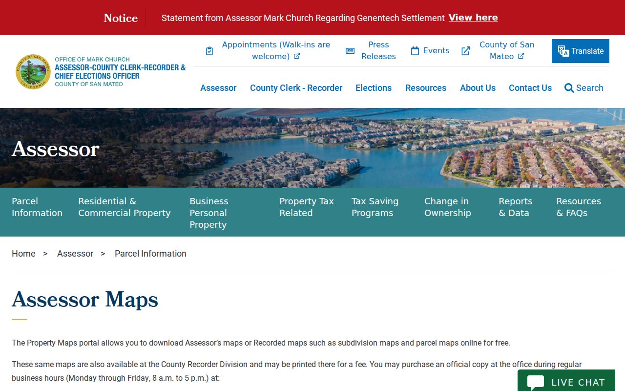
The map screen is most useful when its APN is copied into the assessment roll and RecorderWorks rather than treated as the final answer.
Redwood City GIS for Parcel Layers
Community GIS supports a street-by-street walk. Search an address or parcel number, zoom until the parcel boundary is clear, and note every APN on the target segment. The city layer set includes property information, permit applications, zoning, General Plan land use, council district, neighborhood, trees, flood zones, and bicycle network context. These layers help explain why two nearby addresses may route to different offices or fall in different civic areas.
San Mateo County also provides a county GIS gateway. Its cited parcel layer exposes APN, situs address, and parcel geometry, with technical query tools, but it does not expose owner names in the public layer. Use the county viewer for geometry and the county counter for the Local Assessment Roll. That split is a key address-record safeguard.
The Redwood City Community GIS viewer is the better starting point for adjacent parcels and city jurisdiction. Capture the screen date, layer names, and APNs, then repeat the same scale for each side of a street rather than relying on a visual guess.
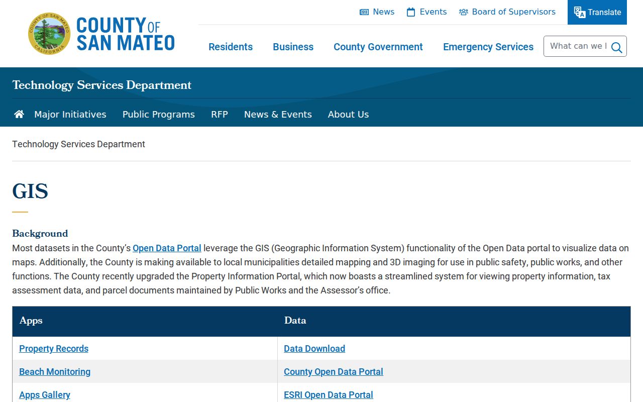
The county GIS view reinforces a useful rule: parcel geometry can be public while a person’s name is held in a different record system.
Redwood City Assessment Roll at County Center
The San Mateo County Assessor’s public Local Assessment Roll is the counter source for assessed owner, land and improvement value, exemptions, and parcel account information. The Assessor counter is on the third floor of 555 County Center in Redwood City. The office lists 650-363-4500 and assessor@smcacre.gov for coverage questions. A public roll inspection is not the same as a remote, unrestricted owner-name parcel search. The county research supports address and APN map routes online, but not a verified Internet parcel-card search by owner name.
The county assessment-roll guidance explains the distinction between a public roll and a web map. Read an assessed owner as a property record, not as a claim about the people at the address. Compare the date and APN, and treat exemptions as roll fields rather than personal facts about a household.
The county assessment-roll screen used for a Redwood City street directory search is shown here:
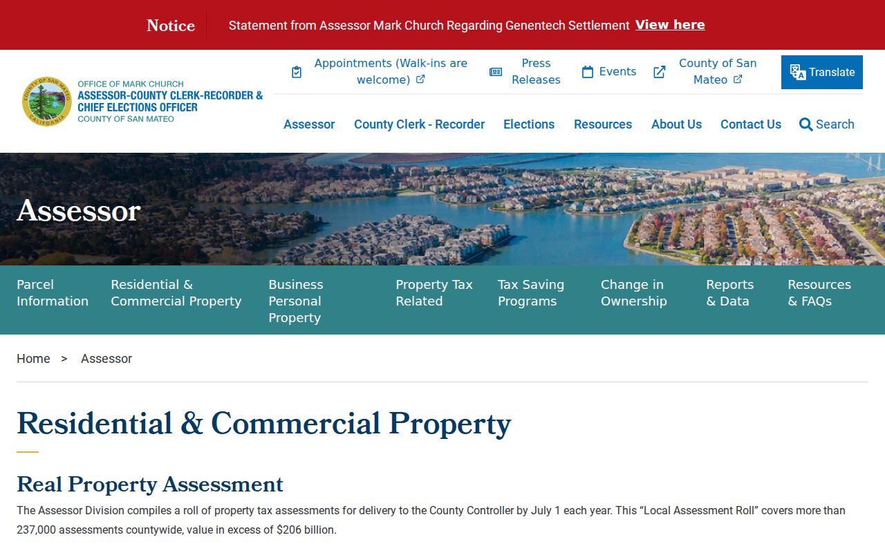
The roll is strongest when its APN agrees with the map and its owner name leads to a recorded instrument. A single roll entry cannot show all occupants or the date someone moved.
Tax history is a separate clue. The San Mateo County Tax Collector provides parcel-keyed tax viewing without a login, subject to the information the service displays. A tax bill can confirm parcel context and payment status, but it does not turn a tax mailing address into a residence.
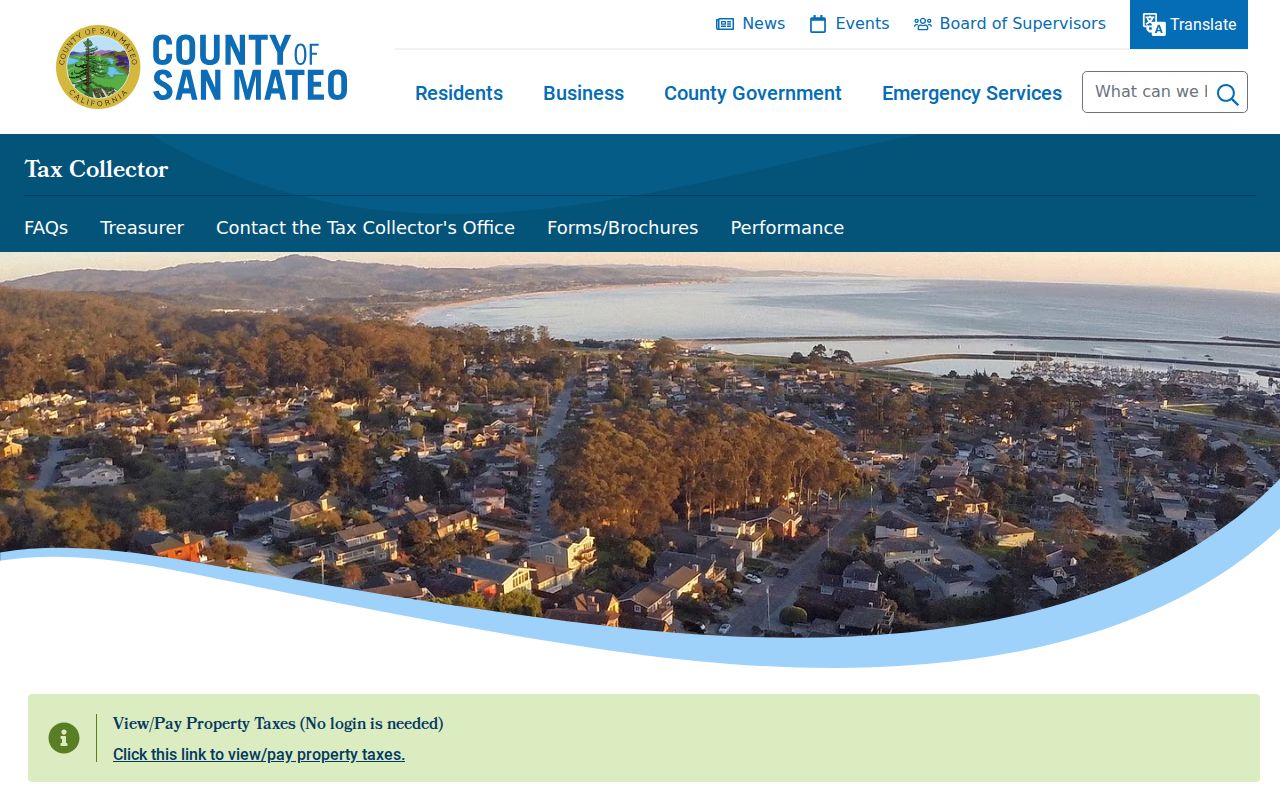
Use the tax screen to test the parcel number, then return to the assessment roll and deed index for ownership evidence. The three records should be aligned by parcel and date.
Myth check. Official county sources support counter access to assessed-owner data and web address or APN maps. They do not support an unrestricted public Internet owner-name assessor directory.
Redwood City Permit History on a Street
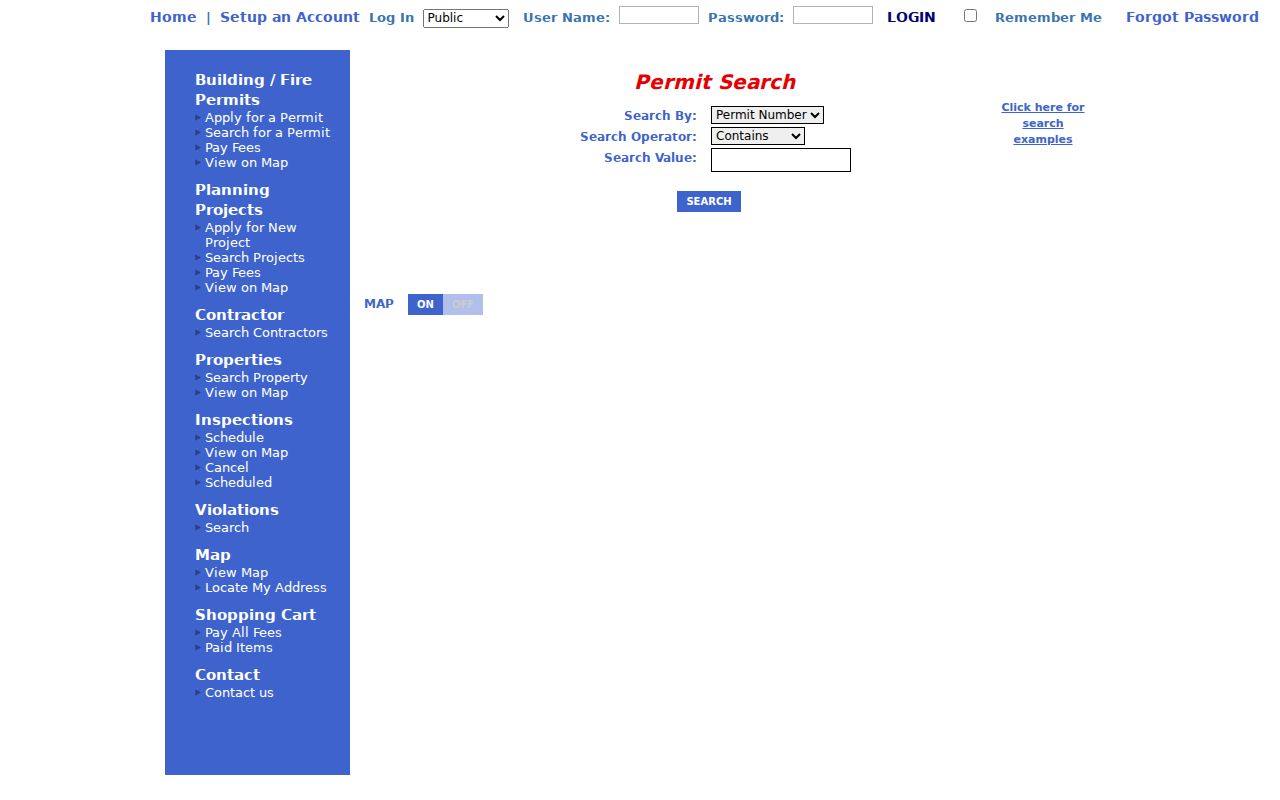
Redwood City eTRAKiT is an address-keyed supplement to a street directory. The public permit search accepts a Search By choice such as Permit Number, Address, PERMITTYPE, STATUS, SITE_APN, APPLIED, APPROVED, ISSUED, FINALED, or DESCRIPTION. Search Operator choices include Begins With, Contains, Equals, At Least, and At Most. The value format depends on the field. Search is public, while account setup is for application and submission functions.
The eTRAKiT permit search can place an improvement in time and parcel context. Its result is not an occupancy record. An applicant, contractor, architect, or other contact may appear without being the owner or a resident.
The public permit form gives a useful street-directory view of the city’s address search:
When an online result is incomplete, the Permit Center at 1017 Middlefield Road and the Community Development contacts are the next channel. The research lists permit help at 650-780-7350 and code enforcement at 650-780-7577. Counter service is listed Monday through Thursday from 10 a.m. to 4 p.m., with virtual Friday service listed from 8 a.m. to 5 p.m.
Redwood City Planning Projects by Address
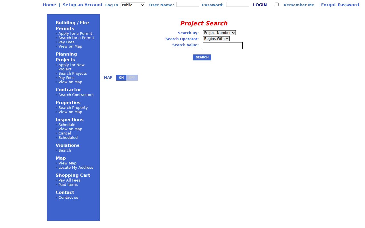
Planning-project records add a second eTRAKiT path for a street. Project Search By includes Project Number, Address, PROJECTTYPE, STATUS, SITE_APN, APPLIED, APPROVED, CLOSED, DESCRIPTION, and PLANNER. A project record can expose Project Info, Site Info, Contacts, Fees, Inspections, Conditions, Reviews, and Chronology tabs when populated. The chronology can help place an address change or construction phase in time.
The eTRAKiT project search is free to search. Read Contacts as contact information for the project, not proof of title or occupancy. The portal publishes data as accurately as possible without warranting every field, so a consequential point should be checked against a permit file or another custodian record.
The planning-project screen connects a street search to the city’s public milestones:
For a file that is not online, use the Redwood City public-records request portal. Describe the address, APN, date range, and department. Under Government Code section 7922.535, the city normally determines whether disclosable records exist within 10 calendar days and may extend that determination by 14 days in qualifying unusual circumstances. That deadline is not a promise that production will be complete.
Redwood City RecorderWorks and Older Deed Indexes
RecorderWorks is the name-and-parcel bridge in a Redwood City street directory. The free index covers recorded real-property documents from 1985 forward. Search modes include Name, Document Number, Document Type, Map, Recording Date, Book and Page, Predefined Search, and Options. Name searches use LAST FIRST format and can allow a partial match. Other fields include a date pair, document number, book and page, controlled document type, APN, predefined lien or change-in-ownership searches, and a document-number range.
Open a document number to see indexed party names, document type, recording date, page count, APN when indexed, book and page placement, and a selection control. The image is not displayed online. Free public terminals at the recorder counter allow viewing, while a mail request to the ACRE Customer Service Desk at 555 County Center, first floor, Redwood City, can request a copy with parties, document type, recording date or number, payment, and a self-addressed stamped envelope. The stated copy fee is $5 for the first page and $1 for each additional page, with certification adding $5 and a conformed copy listed at $10.
Before 1985, staff and legacy index-book or fiche controls matter. The research confirms a pre-1985 continuation but not an unrestricted remote cutoff. Ask the Recorder Division for the correct old index series, then search both names and the legal description when an APN changed after a split or merger. A grantor conveys an interest; a grantee receives it. Those roles must be read from the instrument rather than inferred from a name hit.
The county copy-order instructions explain the counter and mail paths. RecorderWorks is an index, not the deed image, and an indexed party is not automatically the person living at the situs.
Note: Legacy index books and fiche can preserve the older chain when a web search stops at the 1985 computerized boundary.
Redwood City Streets, ZIPs and Mezesville
Postal geography and city geography do not always line up. The city plan uses 94061 for areas south of Jefferson, 94062 for areas north of Jefferson, 94063 for downtown and east of El Camino Real, and 94065 for Redwood Shores. Nearby North Fair Oaks can use Redwood City mailing information while remaining outside incorporated Redwood City. ZIP 94025 is a useful warning because postal locality and municipal boundary can differ. ZIP 94064 appears in USPS destination material, but its special or post-office-only character was not verified and should not be described as a standard residential area.
Use the USPS address route to check delivery information for one address, then use Community GIS to check city limits and parcel jurisdiction. Do not promise a ZIP-wide parcel export from the assessor, RecorderWorks, or eTRAKiT. Those systems are keyed mainly to address, APN, name, document, or project fields.
Redwood City’s downtown grid grew from Simon Mezes’s Rancho de las Pulgas land and the surveyed Mezesville lots. Later annexations reached toward the hills and the Bay, while Redwood Shores remained geographically distinct from the historic core. No verified year for a citywide street renumbering was found. When an old number fails, test the lot, block, map, APN, and legal description instead of inventing a renumbering date.
Redwood City Street Directory History Clues
Older address work depends on the Karl A. Vollmayer Local History Room at the Downtown Library. Its city directories run from 1907 to 1965 and include 1979, while San Mateo County Historical Association material documents an R.L. Polk run from 1920 to 1976. The named 1965 and 1976 Polk examples are verified, but every volume should be checked before calling a particular edition Polk. The shelf also holds 1919 Sanborn maps with 1959 revisions, maps from the 1860s through the 1950s, voter logs from the 1920s and 1940s, tax rolls, newspapers, and special local files.
For a past address association, compare the directory entry with an adjacent edition, the map footprint, a tax roll, and a deed. A directory can show that a name was printed with an address, but the assessment roll and recorded instrument answer different ownership questions. The Redwood City Directory Book page covers the historical collections and how to inspect an entry without assuming unverified spouse, occupation, or reverse-directory fields.
The local history shelf is also an access fallback. Visits are arranged through the Local History Room, and the noncirculating material is read in place or copied when permitted. Photograph the title page, edition year, page, and abbreviation key with each transcription so a later search can be repeated.
Limits of a Redwood City Street Directory
A Redwood City street directory cannot show everyone who lives on a street. The county parcel layer exposes APN, situs, and geometry, not owner names. The assessment roll identifies an assessed owner, not every occupant. A deed records an interest, not a current household. A permit lists an application contact, not a resident. DMV personal data is restricted, and utility customer lists are not a public street source.
The voter route is especially narrow. The self-service form asks for house number, ZIP code, and birth date. A whole-street voter file requires an approved purpose under Elections Code section 2194, and confidential fields such as signature, identification numbers, and protected address information remain closed under Government Code section 7924.000. Safe at Home can place a substitute address into government records for eligible participants, so a missing match can be a deliberate protection.
Keep a search log with the address spelling, APN, date, portal, filters, and result. If a result is wrong, contact the custodian rather than trying to reconcile the error through a different person’s records. A negative result may reflect an APN change, a name variation, a protected address, a sealed file, or a pre-digital gap.
Lawful use. Redwood City street and address records are suitable for lawful personal research, family history, property review, and civic work. Never use a name, address, or record trail to stalk, harass, threaten, or intimidate anyone.